The Channel Islands are a chain of eight islands off the coast of Southern California.
It is a swimmer’s paradise, with pristine waters, astonishing biodiversity and year-round mild temperatures. There are dozens of potential swim routes in this area, some of which still remain to be traversed by swimmers.
The SBCSA sanctions solo and relay marathon swims to, from, around, and between the eight Channel Islands (Anacapa, Santa Cruz, Santa Rosa, San Miguel, Santa Barbara, San Nicolas, San Clemente, and Catalina) — with the exception of Catalina Channel and Catalina circumnavigation swims, which are sanctioned by CCSF.

Our most popular swim routes include:
Anacapa to/from mainland - a 12.2-mile (19.6 km) swim between Anacapa Island and Oxnard. This is a great “starter” channel swim in preparation for the Catalina Channel or English Channel. For more information see our Anacapa roadmap.
Anacapa circumnavigation - a 10.6-mile (17 km) swim around Anacapa Island. A scenic swim around passing by some of the most iconic sights of Channel Islands National Park such as Arch Rock.
Santa Cruz Island to/from mainland - 19.1 miles (30.7 km) to Oxnard or 23.5 miles (37.8 km) to Santa Barbara. Similar in distance, temperature, and conditions to the English Channel.
World-class channel swims, longer and tougher than the English Channel or Catalina, include the swims between the mainland and Santa Rosa, San Miguel, or Santa Barbara Island, as well as the offshore route between Santa Barbara Island and Catalina.
Shorter (< 10 km) island hopper routes, which can be stitched together back-to-back, include the swims between Anacapa, Santa Cruz, Santa Rosa, and San Miguel Islands.
Numerous other unprecedented or nearly-unprecedented channel swims, circumnavigations, or inter-island swims are possible but not explicitly mentioned here. Contact the SBCSA for further information.
Click on the image below to download the “Anacapa Roadmap.”

Channel Swims
(Research done by Evan Morrison, former board member and President of the SBCSA.)
The SBCSA sanctions channel crossings between the mainland and seven of the eight Channel Islands (except Catalina). These swims range from 20 km / 12.2 miles (Anacapa) to 100 km / 62 miles (San Nicolas).
Northern Islands
Standard route: East Anacapa Island (near Arch Rock) to Silver Strand Beach, Oxnard
Distance: 12.2 statute miles (20 km). Recommended experience: Any 10km swim in similar water temperature.
Anacapa is the closest Channel Island to the California mainland, just over 12 miles by the shortest straight-line route. This is the SBCSA's most popular swim route - a bona-fide channel swim at an accessible distance. Anacapa is the closest Channel Island to the California mainland, just over 12 miles by the shortest straight-line route. This is the SBCSA's most popular swim route - a bona-fide channel swim at an accessible distance. See the “Anacapa Roadmap,” written by Dave Van Mouwerik, above.
Santa Cruz
Distance: to Oxnard (San Pedro Point to Hollywood Beach) 19 miles (30 km); to Santa Barbara (Diablo Anchorage to Leadbetter Beach) 23.6 miles (39 km).
Santa Cruz Island is the "crown jewel” of the Channel Islands archipelago, and features prominently on the horizon along most of the Santa Barbara and Ventura County coastline. The geography of the island (23 miles from end-to-end) supports two distinct swim routes to the mainland: from the east end to Oxnard; and from mid-island to Santa Barbara. The Santa Barbara route was pioneered in 1926 by the Kelp Club relay team - the first recorded channel swim in California history. The Oxnard route (pioneered by David Yudovin in 1982) is the shortest route to the mainland and follows a similar bearing as the Anacapa swim.
Santa Rosa
Distance: 27.4 miles (44 km) from Carrington Point to Coal Oil Point
Santa Rosa Island, second-largest of the Channel Islands, is visible on clear days from the Goleta and Gaviota coast. The island is “rimmed with smooth marine terraces, stark cliffs, isolated beaches, and pristine tide pools still largely untouched from when prehistoric pygmy mammoths roamed its hills and canyons.
The shortest route to the mainland is 27.4 miles, from Carrington Point to Coal Oil Point, near the campus of University of California, Santa Barbara. This is the widest part of the Santa Barbara Channel. In 2008, Marc Lewis of San Diego became the first solo swimmer to make the crossing. A documentary of this monumental swim can be viewed HERE. In 2018, Caroline Block became the second solo swimmer and first woman.
San Miguel
Distance: 26.7 miles (43 km) from Harris Point to Government Point / Coho Bay (Hollister Ranch)
San Miguel is the westernmost Channel Island and the most exposed to the predominant northwest winds and swells rolling in off the Pacific Ocean. This part of the channel offers the coldest water and most challenging swim conditions in all the Channel Islands.
Only one swimmer has made the 26.7-mile solo crossing - Penny Palfrey of Australia. The shortest route is between Harris Point at the northern tip of the island and Government Point, just east of Point Conception. A protected cove and sandy beach is available at nearby Cojo Bay. Miles of sandy coastline extend further east along the Hollister Ranch property.
Southern Islands
The Southern Channel Islands offer wild open ocean and lands only rarely visible from the mainland.
Santa Barbara
Distance: 38-40 miles (61-64 km) from Arch Point to Point Dume (Malibu) or Point Vicente (Palos Verdes). Recommended experience: 25+ mile swim in similar water temperature.
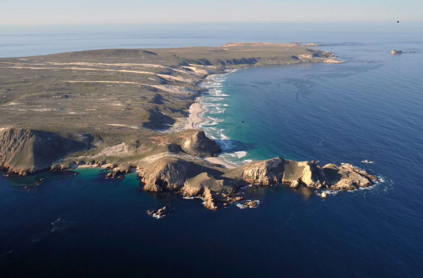
Tiny Santa Barbara Island is the easternmost member of Channel Islands National Park. On a clear day, six of the seven other islands (except San Miguel), can be seen from atop the island's prow.
From SBI's northern tip (Arch Point), you'll aim for either end of Santa Monica Bay - either Point Dume (Malibu) or Point Vicente (Palos Verdes). The Point Dume route is shorter (37.7 miles), but prevailing winds and currents may make Point Vicente (40 miles) a preferable destination.
In 2009, Penny Palfrey completed the first and solo swim between SBI and the mainland (finishing at Point Vicente).
San Clemente
Distance: 52 miles (84 km) from Northeast San Clemente, around the west end of Catalina Island, to Point Vicente (Palos Verdes). Recommended experience: double English Channel, double Catalina, or equivalent.
Access to San Clemente Island is restricted, and you must obtain permission from the Navy to swim to or from its beaches.
San Clemente Island, owned and operated by the United States Navy, is visible off the back side of Catalina Island but rarely from the mainland. Some relevant information is available HERE.
If granted permission from the Navy, a swimmer will likely depart from the northeast corner of the island. The shortest route to the mainland is around the west end of Catalina Island and finishing at Point Vicente (52 miles).
In 2011, Tina Neill completed the first and only solo swim between San Clemente Island and the mainland, finishing near Point Vicente (via the west end of Catalina) in 28 hours, 41 minutes.
San Nicolas
Distance: 62-70 miles (100-112 km) from Cissy Cove to Point Mugu (Oxnard) or Point Vicente (Palos Verdes). Recommended experience: double English Channel, double Catalina, or equivalent.
Access to San Nicolas Island is restricted, and you must obtain permission from the Navy to swim to or from its beaches.
San Nicolas Island is the most remote Channel Island, more than 60 miles off the mainland by shortest route. Like San Clemente Island, San Nic is an active Naval base with restricted access. The island is perhaps best known as the former home of the Lone Woman of San Nicolas Island, immortalized in Scott O'Dell's children's novel The Island of the Blue Dolphins.
The shortest route to the mainland finishes at Point Mugu, near Oxnard (61.7 miles). However, prevailing winds and currents may make a Point Vicente finish more favorable despite ~7 additional miles of distance.
The Deep Enders relay is the only successful swim off San Nicolas (33 hours, 37 minutes in 2015).
Circumnavigations
Official distances are measured according to the shortest (tightest) possible route around the island. In most cases the actual path swum is somewhat wider.
Swims must start and finish by touching land - either clearing the water on a beach or touching a cliff face.
The swim is complete when the swimmer has "closed the circle" by clearing the water or touching a cliff face beyond the starting point.
Swim descriptions ordered by distance (shortest to longest).
Santa Barbara Island
Distance: 5 miles (8.1 km)
The official route passes inside of Sutil Island (i.e., between Sutil and the main part of SBI) but outside the various unnamed near-shore rocks.
Anacapa Island
Distance: 10.8 miles (17.5 km)
An official circum-swim of Anacapa requires swimming around all three islets (East, Middle, and West). Swimming between any of the islets, even if possible, is considered cutting the course. Additionally, SBCSA-sanctioned swims must pass outside Arch Rock.
San Nicolas Island
Distance 21.3 miles (34.3 km)
San Nicolas Island is an active Naval base, and you must obtain permission from the Navy to swim to or from its beaches.
San Miguel Island
Distance: 21.7 miles (35 km)
The southwest edge of San Miguel Island is a sensitive marine habitat which includes a large elephant seal rookery at Point Bennett. For circumnavigation swims, both swimmers and their escorts should stay at least 300 yards offshore between Castle Rock and Judith Rock.
Santa Rosa Island
Distance: 41.3 miles (66.5 km)
The waters around Santa Rosa Island are dotted by numerous shoals and rocks which may not be visible at certain tides. Boaters are advised to closely consult nautical charts and remain a safe distance offshore.
San Clemente Island
Distance: 46.5 miles (75.9 km)
San Clemente Island is an active Naval base, and you must obtain permission from the Navy to swim to or from its beaches. Additionally, certain parts of the San Clemente Island coastline are restricted to all marine traffic to 3 nautical miles offshore. More information HERE.
Santa Cruz Island
Distance: 53.7 miles (86.5 km)
Island Hopper
Northern Islands
Anacapa-Santa Cruz
Distance: 4.6 miles (7.4 km)
Suggested route: West Point (Anacapa Island) to/from San Pedro Point (Santa Cruz Island)
Santa Cruz-Santa Rosa
Distance: 5.5 miles (8.9 km)
Suggested route: Kinton Point (Santa Cruz Island) to/from Skunk Point (Santa Rosa Island)
Santa Rosa-San Miguel
Distance: 3.6 miles (5.8 km)
Suggested route: Sandy Point (Santa Rosa Island) to/from Cardwell Point (San Miguel Island)
Southern Islands
San Clemente-Catalina
Distance: 21.5 miles (34.6 km)
Suggested route: LCI Point (San Clemente Island) to/from beach east of China Point (Catalina Island)
Santa Barbara-Catalina
Distance 24.6 miles (39.6)
Suggested route: Arch Point (Santa Barbara Island) to/from Catalina west end
San Nicolas-Santa Barbara
Distance: 29.3 miles (47.2)
Suggested route: Cissy Cove (San Nicolas Island) to/from southwest Santa Barbara Island
Santa Barbara-Anacapa
Distance: 41 miles (70 km)
Suggested route: Arch Point (Santa Barbara Island) to/from Anacapa east end (near Arch Rock)
** Several other island hopper routes are theoretically possible - all longer than 50 miles. **
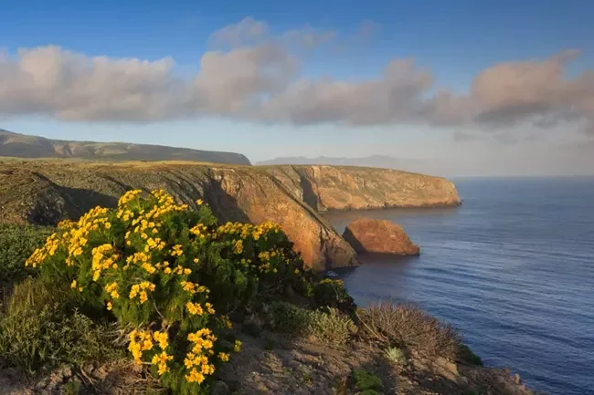
Santa Cruz Island. Image from nps.gov.
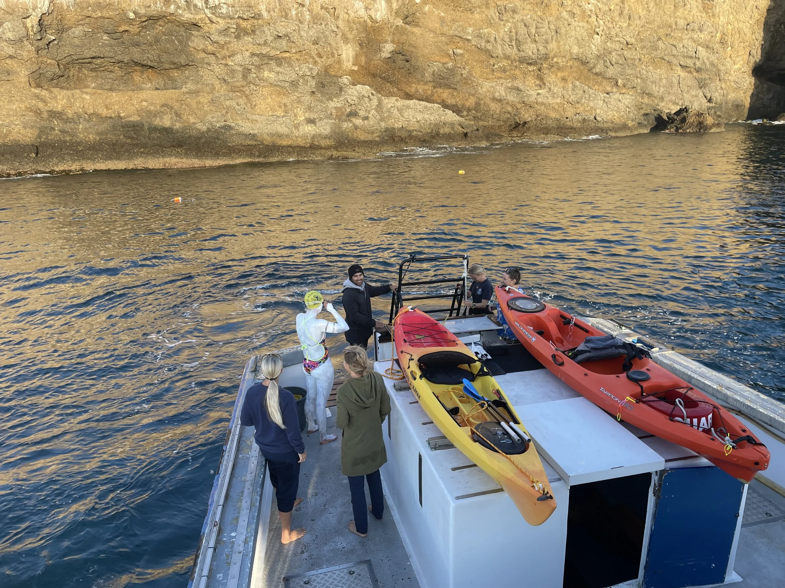
Jessica Kieras and crew at Santa Barbra Island in 2022 when she completed the second successful solo to the mainland.